I was browsing the Britain From Above website earlier and spotted a couple of new photos for Hoylake and Meols.
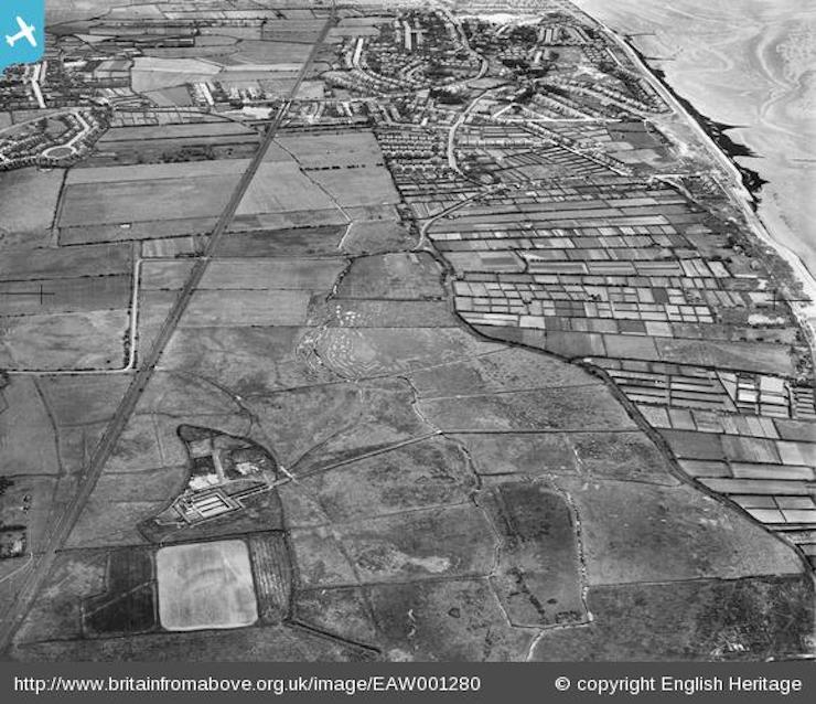
The aerial photo above (source), was taken in June, 1946 and shows what is described as the Wallasey Corporation Sewage Works (presumably that big square and building next to it and not to be confused with the current United Utilities plant) and the allotments at Parkfields. You can make out the location of Meols Station where the railway line intersects with the main road with Meols Pond next it and Barn Hey Crescent further to the left.
Looks like there used to be a lot of allotments down there …you can’t get one today for love nor money of course, waiting lists go on for years ahead! So when was this area subsequently used as caravan parks – after 1946 obviously? Does anyone know who owns the fields down Park Lane today – is it all private land or does the Council own any of it?
There used to be an accessible air-raid shelter in Park Lane and my old penknife might possibly still be there somewheres! I can also recall that the detached house on the road, just off the corner at Bennets Lane was derelict for years and you could sneak in there too if you dared. That was after you had a rummage through the old black cars that used to be in the farmer’s field at the end of Cleveley Road.
If you go down Park Lane (bike or foot), past the caravan parks you’ll come to a gate – turn left on the path that takes you to the prom or go straight on, through the gate and along to Leasowe Lighthouse. Mind that the narrow path is accessible though, as last time I ran along there it was pretty overgrown.
Comments